


Rainy Days Rain Radar

وصف لـRainy Days Rain Radar
NOTE: Currently there's an outage at weather.gov which means that data may not be fully up to date!
If you have questions, problems, feedback, please send me an email.
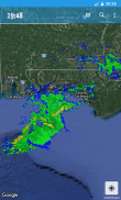
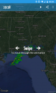
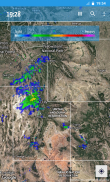
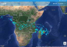
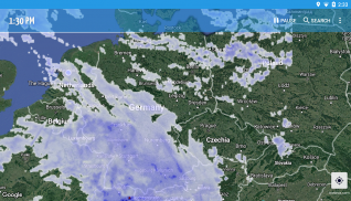
Rainy Days shows you weather radar doppler observations from multiple sources on a fully interactive map. You can zoom in, pan and search for locations.
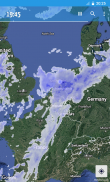
Rainy Days uses multiple sources of data, not one map for the whole world. This gives you the most recent data for your location. Therefore, Rainy Days works best when zooming in to your local area.
Rainy Days uses real doppler observations and only falls back to satellite sourced data for areas without any doppler radars present.
Predict the weather with Rainy Days: see how storms are moving to see if they are heading for you.
Coverage: Europe, Scandinavia, USA incl Alaska, Canada, Hawaii, Puerto Rico, Africa, Australia
Note: shows rain (radar reflectivity), not clouds!
If something is not working on your device, please send me an email, adding a comment doesn't give me enough information to fix any bugs!
ملاحظة: يوجد حاليًا انقطاع في weather.gov مما يعني أن البيانات قد لا تكون محدثة تمامًا!
إذا كان لديك أسئلة ، ومشاكل ، وردود فعل ، يرجى إرسال بريد إلكتروني إليّ.
يوم ممطر يظهر لك رصدات رادار دوبلر الطقس من مصادر متعددة على خريطة تفاعلية بالكامل. يمكنك تكبير المواقع والبحث عنها والبحث عنها.
تستخدم Rainy Days مصادر متعددة للبيانات ، وليس خريطة واحدة للعالم كله. يمنحك هذا أحدث البيانات لموقعك. لذلك ، يعمل Rainy Days بشكل أفضل عند التكبير إلى منطقتك المحلية.
تستخدم Rainy Days ملاحظات دوبلر حقيقية وتعود فقط إلى بيانات مصادر الأقمار الصناعية للمناطق دون وجود أي رادارات دوبلر.
توقع الطقس مع Rainy Days: شاهد كيف تتحرك العواصف لمعرفة ما إذا كانت متجهة إليك.
التغطية: أوروبا ، اسكندنافيا ، الولايات المتحدة الأمريكية بما في ذلك ألاسكا ، كندا ، هاواي ، بورتوريكو ، أفريقيا ، أستراليا
ملاحظة: يظهر المطر (انعكاسية الرادار) ، وليس الغيوم!
إذا كان هناك شيء لا يعمل على جهازك ، فيرجى إرسال رسالة إلكترونية إليّ ، حيث إن إضافة تعليق لا يعطيني معلومات كافية لإصلاح أي أخطاء!


